
Description
ISBN: 9416458075452
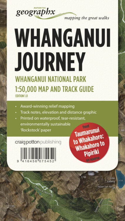
Title: Whanganui Journey – Whanganui National Park Map
Author: GEOGRAPHIX MAPSMITHS
Blurb: Edition 1 2014
Scale 1:50,000
The Whanganui River winds its way from the mountains to the Tasman Sea through countless hills and valleys. This journey lets you take a multi-day canoe or kayak trip to experience its most remote scenic beauty, history and cultural significance.
The Whanganui Journey passes through Whanganui National Park, in the south-west of the North Island, and is very accessible from State Highway 4 (SH4). Choose a 5 day journey from Taumarunui to Pipiriki (145 km), or a shorter, 3 day journey starting at Whakahoro (87 km), featuring the most scenic stretches of the river.
Features:
Taumarunui to Whakahoro 3D Map on Front – Whakahoro to Pipiriki 3D Map on reverse
145 km and 203 rapids of grade 1 and 2 canoeing
Award-winning relief mapping
Printed on waterproof, durable, environmentally sustainable ‘Rockstock‘ paper.
Binding: MP
Pages: 0
Available Stock: 1


Reviews
There are no reviews yet.